Application Areas

Planning

Planning of fire safety requirements and rescue service zones

Result of the accessibility analysis for individual periods of time (area picture)
Result of the accessibility analysis for determining response areas

According to laws and regulations, authorities are obliged to plan fire safety requirements in detail in order to determine the necessary staff and resources for emergency response actions. These plans are based on scientific hazard analyses and risk assessments. Such evaluations include the analysis of response times, infrastructures and risks as well as elaborated concepts for the positioning of rescue means.

The calculation of the fire department areas is based on the location of fire and rescue stations, the transport network and speed profiles (determined within empirical studies). Alternatives are systematically compared in order to achieve the best possible result.

Analysis of response times

Result of the basic response time analysis and statistics
Result of the detailed response time analysis (green: both response time conditions are met; yellow: response time 1 fulfilled, response time 2 insufficient)

This analysis serves to examine the response times for fire safety and rescue services, which are regulated by state (»Länder«) laws. Response times can be analyzed based on a number of decision criteria, but the majority of planners evaluate the accessibility by surface area only. MobiKat® supports the analysis of various criteria, assuming in general that the frequency of emergency response actions is equally distributed throughout the population. Based on this assumption, MobiKat® evaluates the accessibility of the legally defined share of the population that can be reached within the response time.


The precision of these calculations can be freely chosen. Low resolutions are calculated in real time and can thus be used to assess the current situation. Higher resolutions are suitable for long-term planning – analyses with 1-meter resolution are possible.

For the response time analysis in fire safety planning, the model »critical house fire« is used. The fulfilment of both response times are evaluated separately and in combination with each other. The required resources for the fulfilment of the response time either can originate in one location, or can be gathered from several locations.

Alarm and response order

MobiKat®: decision support for alarm and response orders and operations by calculation of optimized routes, arrival time and order

Control centers often use pre-calculated alarm and response orders for operational disposition. In customizable spatial resolution (administrative level, address, road section), alarm and response orders define the order of relief staff and resources to be alarmed for a certain site of operation. This order is determined using route calculations, in which vehicle types can also be taken into consideration.

External emergency planning

External emergency planning for release of hazardous goods with MobiKat® / DISMA

Based on the Seveso-III regulation, companies dealing with hazardous materials (e.g. production sites of the chemical industry) are obliged to set up external emergency plans. These plans include potential impacts and response actions for various incident scenarios, such as cordoning measures, alternative routes and evacuation planning, all of which can be calculated with MobiKat® modules.

Floor plan of the Dresden Christmas market in MobiKat® map view

When planning large-scale events, a security concept must be developed and approved by the respective authorities. MobiKat® supports organizers, authorities and security staff in creating well-structured plans, which include for instance all locations of life-saving appliances, stages, market stalls, stations for medical/accident assistance, staging bases, assembly points, access roads as well as section boundaries.

The multitude of basic maps and aerial images available in MobiKat® facilitate exact positioning. Accurate and detailed plans for one or more levels (floors) from several formats (including CAD data formats) can be integrated. The organizational structure of the operation is shown as a hierarchy, including the radio communication scheme. Clearly structured bar charts provide an overview of the planned timelines of individual events at different locations, so that overlaps and corresponding demand peaks of staff and resources become visible.

Operational Decision Support

Operational command and documentation

MobiKat® is applied during a large-scale event (Tag der Sachsen 2019)

One of MobiKat®’s core competencies is to digitally support the command of diverse operations. The user can choose from different basic maps, which show a common operational picture using tactical signs. MobiKat® is both suitable for smaller operations as well as the management of disasters such as floods or extreme weather situations. Arriving staff can be added in real time, e.g. when disaster situations are growing. All information, such as the real-time position of relief forces, are synchronized via the MobiKat® server and can be accessed on all MobiKat® devices – including mobile access via an app for Android.

With this synchronization, a common operational picture can be managed across command levels and organizations. The operational command is automatically documented by the system and can be exported afterwards as text protocol or video. A digital operation diary features additional explanations. 

Command Organization

Visualization of command organization in MobiKat®

MobiKat® supports command organization by visualizing the assignment of units and vehicles to operations, operation sections and staff units. In the command organization chart, the command levels, superordinate and subordinate positions, command hierarchies and areas of responsibility are clearly depicted. Any modification in status, intensity or assignment is immediately visible on all MobiKat® workspaces. MobiKat® supports any number of command levels and can be applied for various organization structures in firefighting, police, emergency services as well as in disaster management and security services. 

Mobile command and command vehicles

Picture from the middle-scale command vehicle of the German Red Cross in Dresden

MobiKat® works on all standard PCs, notebooks and tablet PCs, making it suitable for the mobile use in command vehicles of different sizes. With the MobiKat® server, information levels can be synchronized at several mobile command posts. 

MobiKat® also runs on Android
Mobile command: map view of hydrants and details
Mobile command: archive for documents, e.g. fire evacuation plans

Mass-Casualty Incidents (MCI)

MobiKat®: Registration of patient data with Android application

During a mass-casualty incident, a large number of people must – according to their triage category – be treated, distributed and transported to nearby hospitals. For the rapid registration of relevant data about the affected persons, MobiKat® offers a smartphone app that can be safely operated even under adverse working conditions. The app assists non-physician emergency personnel during primary triage. For command staff, MobiKat® provides an overview of registered treatment capacities of hospitals and their current occupancy.

Optimization of firefighting

MobiKat® water pressure calculation for optimal deployment of pumps

If large quantities of water are needed, e.g. during forest fires in remote mountain areas, water has to be transported to the fire location over long distances. MobiKat® assists firefighters in the optimal positioning of fire pumps. After selecting the available hose lengths and diameters and positioning the planned water transport route in the map, MobiKat® visualizes the pressure characteristics and determines the ideal pump locations.

Search and rescue

MobiKat® Search and Rescue: optimizing routes for 3 search teams
MobiKat® Search and Rescue: output of the designated trail for a selected search team

If a person goes missing in a forest or in agricultural areas, search strategies such as grid search, search and rescue along a path/trail or area search are employed. For all strategies, search teams are assembled. To coordinate search teams during a search and rescue along a path/trail, search routes can be calculated to ensure the equal workload of the teams and the optimal search duration.

Video surveillance of critical objects

MobiKat® cameras used to protect markets

Will the dam control the flood? How crowded is the space in front of the stage? In such situations, a visual impression can be helpful. The MobiKat® camera systems, which can also be operated by battery, are in regular use during floods and public events. Using cellular data, these cameras send images from the site of operation to the command center at short intervals. The images are automatically archived and can be analyzed afterwards. In case a wireless or wired internet connection is available, livestreams are also possible.

Images from permanently installed and mobile cameras can be accessed by any web-enabled tablet, PC or smartphone device via the user-friendly MobiKat® camera website. The web system offers custom configuration of access authorizations.

MobiKat® camera system in use during a flood
Image from the camera server website

Master Data Portal

The MobiKat® master data portal is a user-friendly, web-based system. Owing to its scope and functionalities, it stands out from conventional fire department administration software. With its flexible and modular design, the master data portal facilitates the decentralized administration of all relevant master data – not only for firefighters, but also for disaster managers and relief organizations. The responsible users register and update information on staff and resources, equipment, locations and critical infrastructure / endangered objects. Data has to be entered and managed only once in a centralized database, minimizing administration efforts for all involved parties. All MobiKat® functionalities can thus access a uniform and up-to-date data pool.

MobiKat® Master Data Portal: personal dashboard

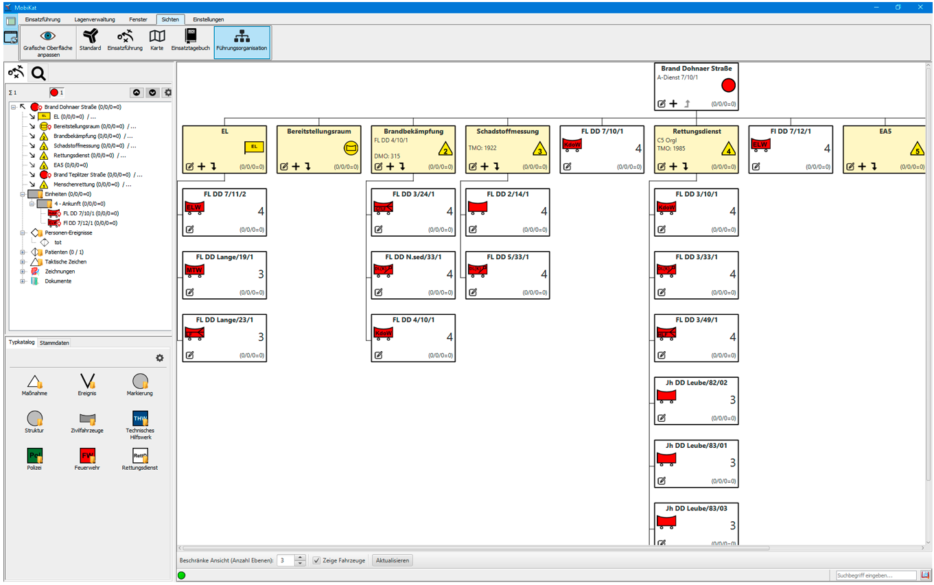
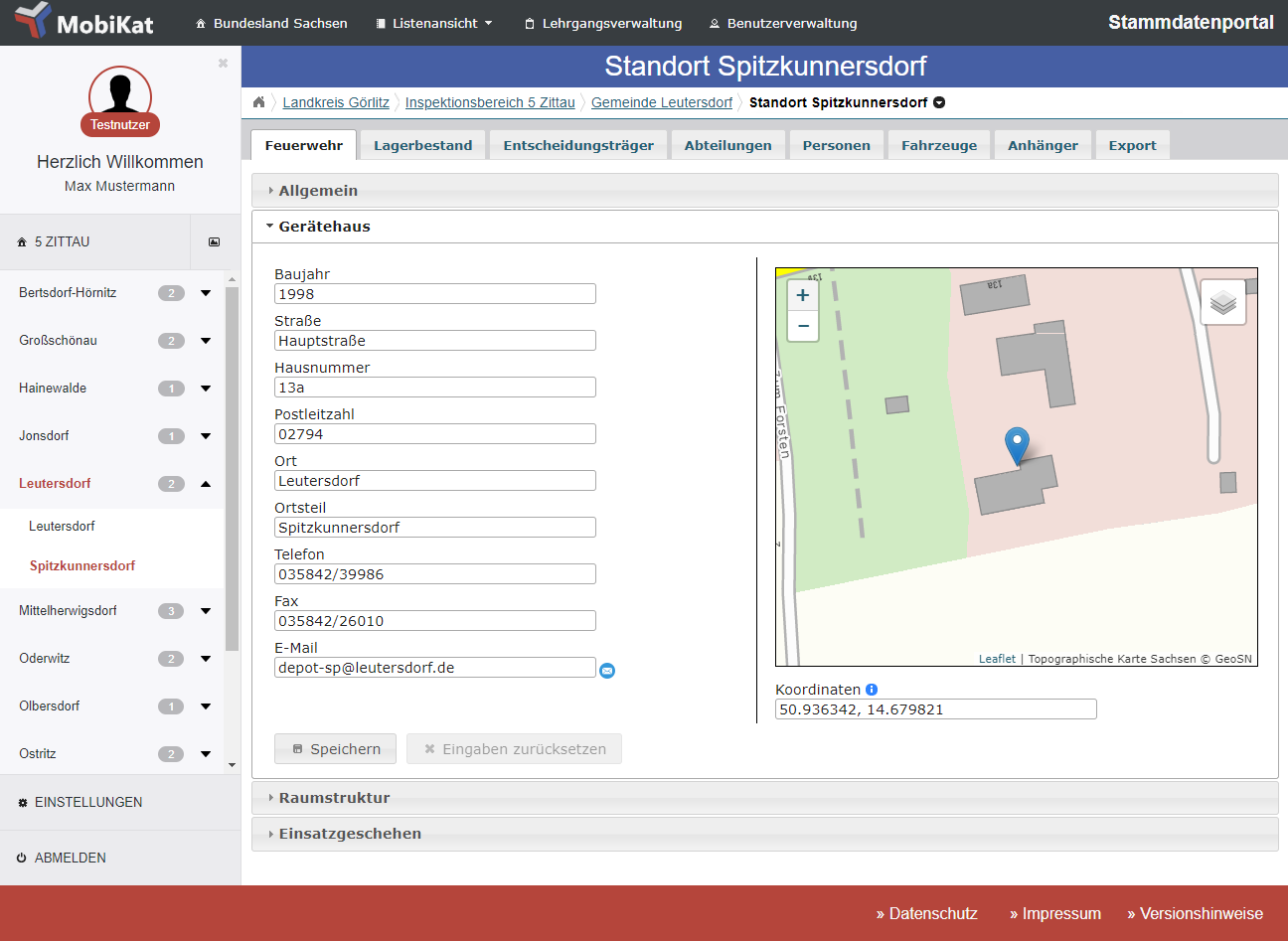
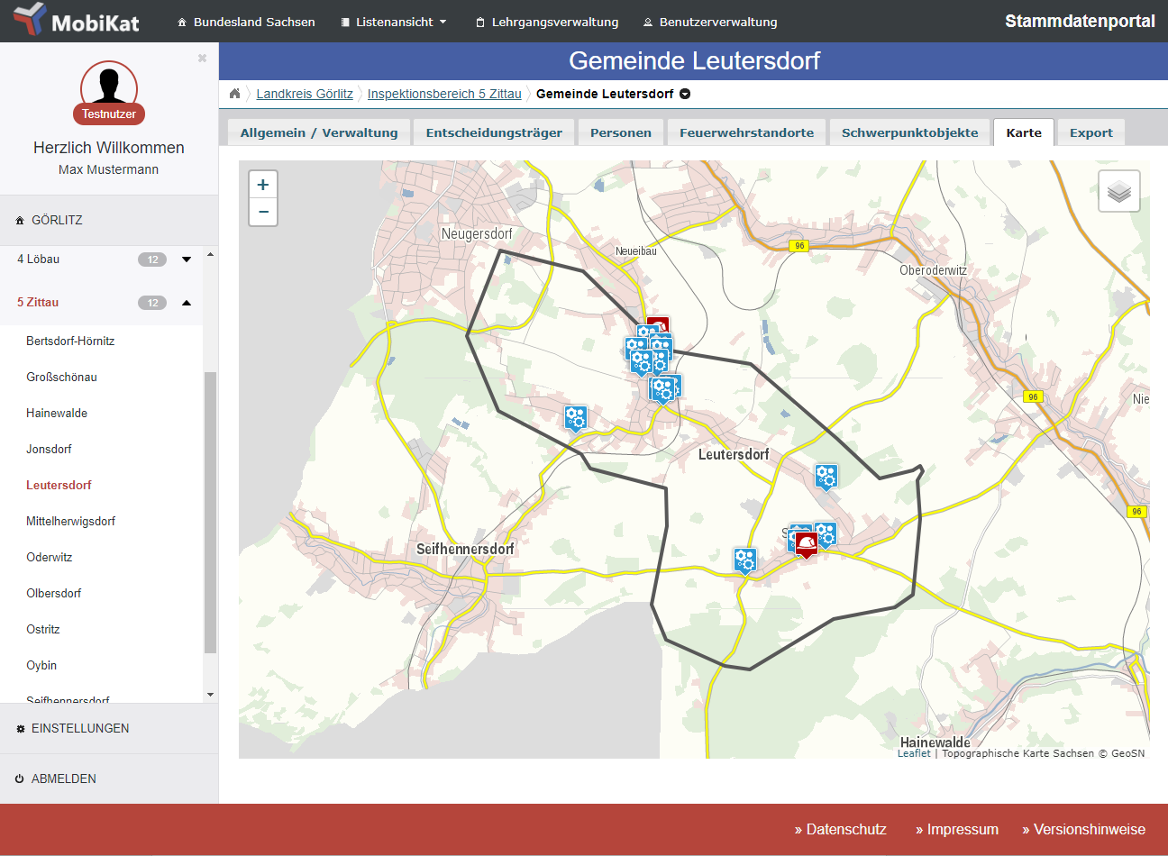
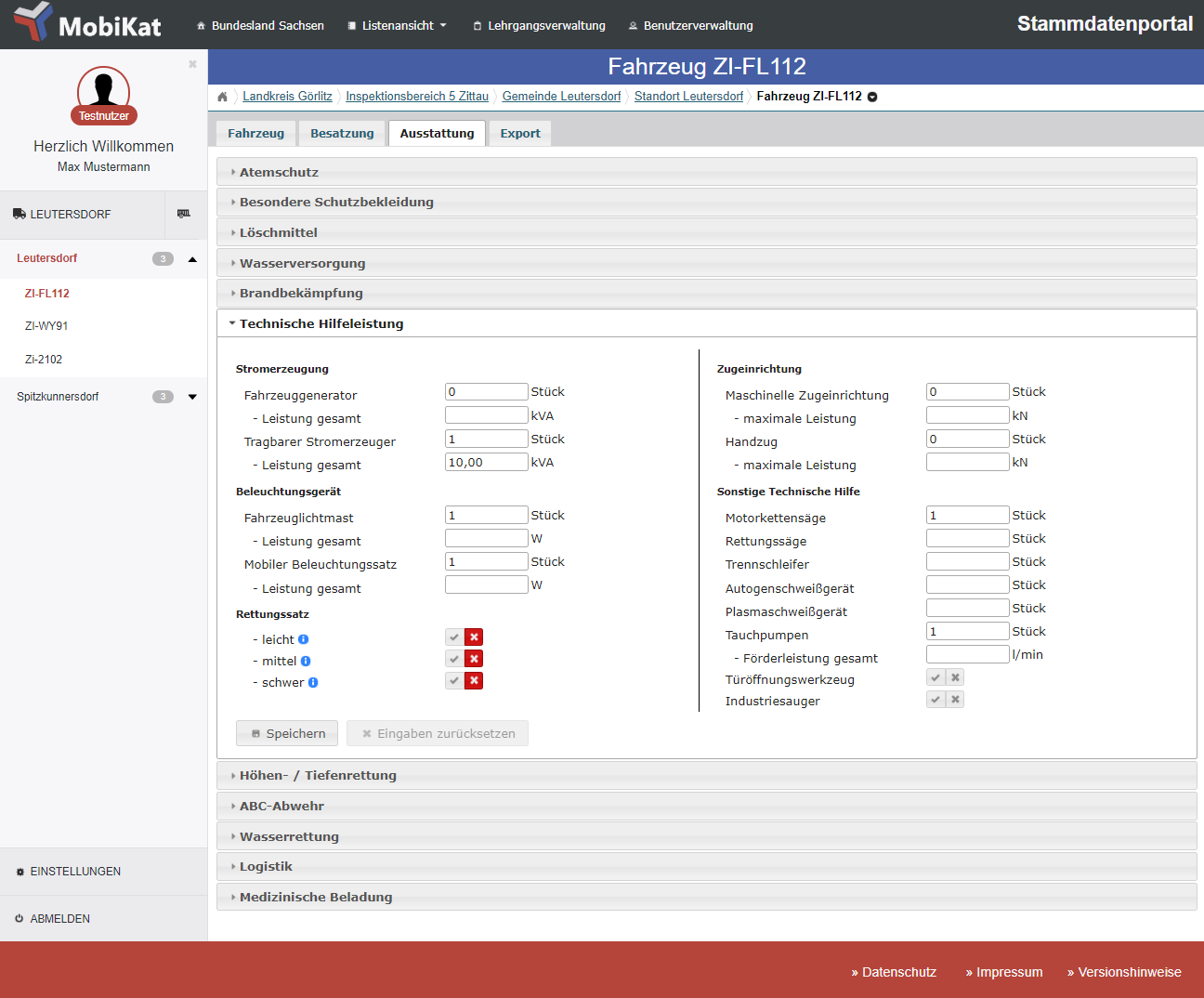
In addition to the administration of general information on organizational structures and available staff, specific and extensive data on vehicles, their load and existing equipment can be documented. The clearly defined role and authorization concept guarantees that only the respective authorized users can access and process the data. By entering individual data on lower levels (e. g. locations, vehicles), aggregated values – such as the entire stock of equipment for one location including all equipment already loaded on the vehicles – are automatically calculated on higher levels (e. g. municipalities, districts).

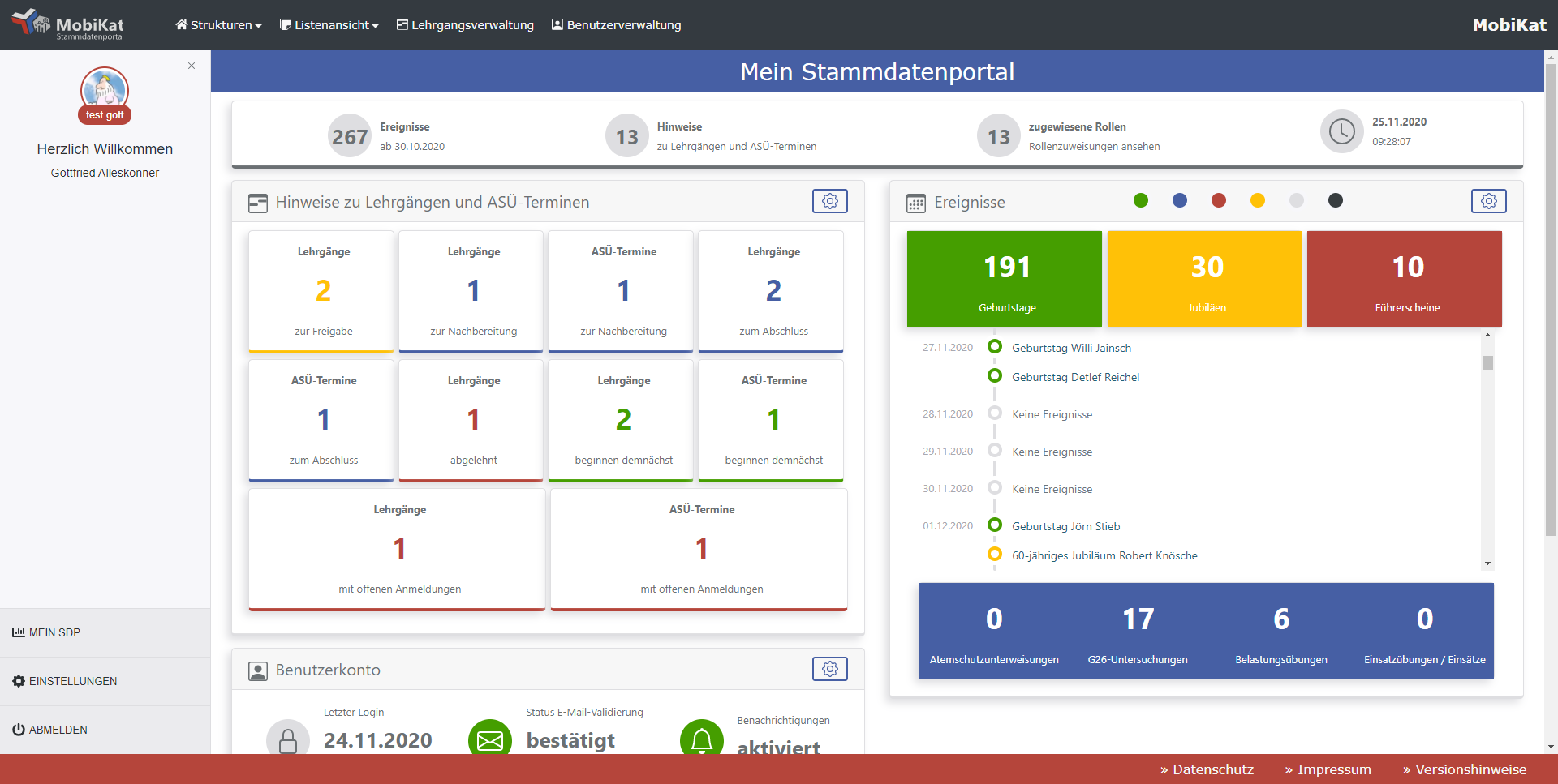
With the level of detail maintained for personal data, information can be exported to Excel and PDF. These include personal data sheets, birthday and attendance lists as well as fire department specific overviews related to anniversaries and breathing apparatus wearers.

In addition, the system has an integrated option for entering and managing courses that is linked to the personal data. It is not only possible to enter courses – the system represents the entire process: Once a course has been entered by the district instructor and approved by the designated person in the district administration, it is published so that registrations can be performed and confirmed by the responsible levels. After the completion of a course, the instructor can enter an evaluation for each participant. Successfully completed courses are automatically transmitted into the participant’s records and the district administration can issue certificates. The system also features a function for organizing fire department specific training facilities for respiratory protection.  


Responsible person:

registers and updates detailed information on: 

District administration, district fire chief, district administrator

  • District

Deputy district fire chief

  • Inspection areas

Municipal (community/volunteer) fire chief, administrator

  • Decision makers and responsibilities in the district administration incl. availabilities
  • Critical infrastructure objects (CI): CI category, contact person, coordinates, precautionary statements, access information and fire evacuation plans
  • Course registration

Local (community/volunteer) fire chief 

  • Fire departments: responsible persons, inventory
  • Staff: personal data, training, qualification
  • Equipment
  • Vehicle / trailer: vehicle data, equipment, crew
  • Course registration

District instructor, district administration

  • Courses incl. dates
Coordinators of training facilities for respiratory protection, district administration
  • Appointment scheduling for training facilities for respiratory protection


Table: Decentralized administration of master data (example: fire department).


The MobiKat® module for operational command can automatically access and use the information entered in the master data portal. Necessary statistics about operations can be generated at any time. The MobiKat® master data portal provides several interfaces for the data to be used in third-party systems, especially in DISMA. With the integrated export functionalities, users can also work offline with the data.

Entering a location
Overview of fire departments of a municipality
Registration of vehicle data
Overview of personal data
Administration of courses

Flood Alerts

MobiKat® offers a web-based system for the proclamation of flood levels and automated information of all responsible staff, e. g. official proclamations for the respective authorities. For each stream gauge, the different warning levels can be individually configured. The current water level and stream gauge are retrieved automatically. If a warning level changes, messages are also sent automatically to an e-mail address or fax number, depending on the user’s choice. For higher warning levels, this information can be secured by adding a manual confirmation step – usually for disaster (pre) alert. Warning levels can be deactivated manually via the web application.

The application offers a clearly structured overview of all stream gauges with

  • the current water levels and warning levels,
  • the persons authorized to change a warning level,
  • the recipients of messages for each stream gauge and
  • a history of the warning messages sent including their status of reception

The MobiKat® flood alerts are based on the official stream gauge data from the respective regional flood center (LHWZ, Landeshochwasserzentrum).

MobiKat® flood alerts: automatically generated e-mail for reaching a warning level
MobiKat® flood alerts: message history
MobiKat® flood alerts: overview of stream gauges